Smart Level
SHOP NOW
Consultation Call+1 (800) 472 3741
Smart Level
  • Home
  • About
  • Features
    • Image Mapping
    • 3D Terrain Mapping
    • 3D Pool Design & Installation
    • Home Inspection & Foundation Repair
  • FAQ
  • BUY NOW
  • Contact
FacebookYoutube
THE TRUE SMART LEVEL WITH BLUETOOTH HAS ARRIVED
Smart Level
  • Home
  • About
  • Features
    • Image Mapping
    • 3D Terrain Mapping
    • 3D Pool Design & Installation
    • Home Inspection & Foundation Repair
  • FAQ
  • BUY NOW
  • Contact
FacebookYoutube
© Copyright 2025
Services

Image Mapping

A Game Changing Innovation

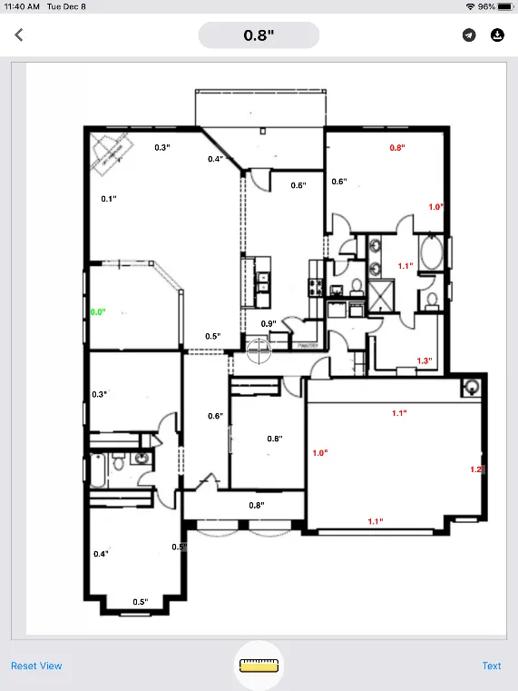
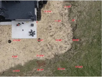
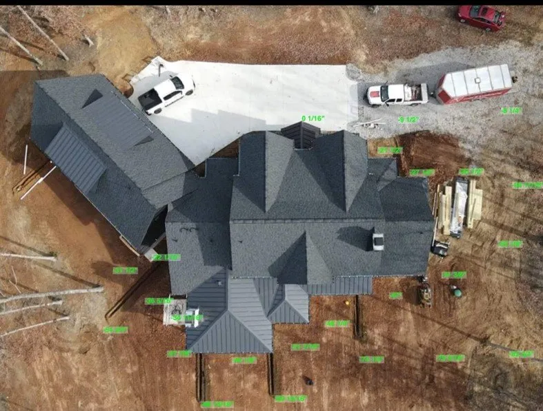
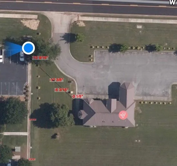
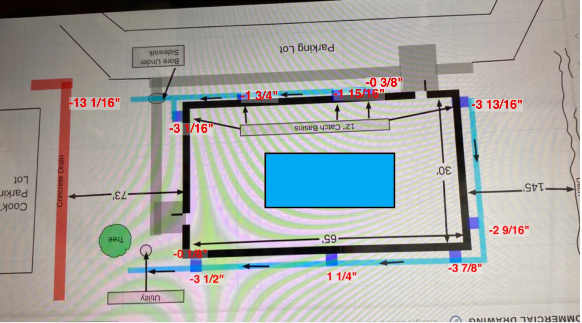
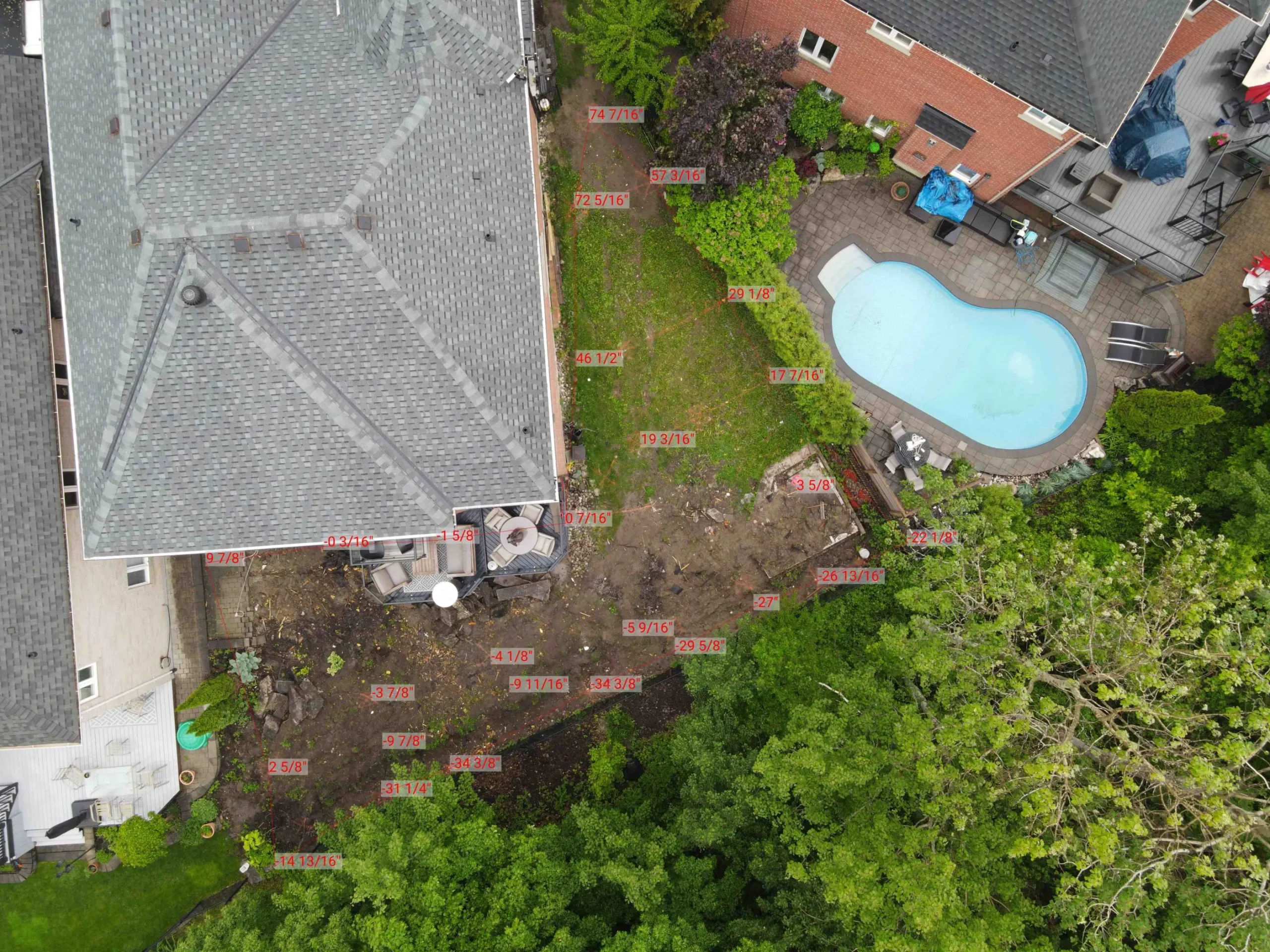
Simply load a photo from your phone into the app and then Smart Level will plot height and distance measurements directly into the image. This can be a photo you took on the job site with your phone, a drone image, a google map image, a pdf of a floor plan. Just about anything you need to measure and document. 

  1. Load the image
  2. Set the Smart Level display where you want to measure.
  3. Align the crosshairs in the image with where you have set the display.
  4. Click add reading in the app. Its as easy as that!
SHOP NOW

SEE THE SMART LEVEL IMAGE MAPPING IN ACTION

Free Consultation and Make an Appointment

FREE CONSULTATION FREE CONSULTATION

Smart Level

  • Call us: +1 (800) 472 3741
  • Email: mike@smartlevel.us

Shortcuts

User Guides
Video Resources

Quick Access

Terms & Conditions
Privacy Policy
Copyright © 2025 smartlevel.uk. All Rights Reserved
Contact Us
 
Privacy Policy
Free Consultation