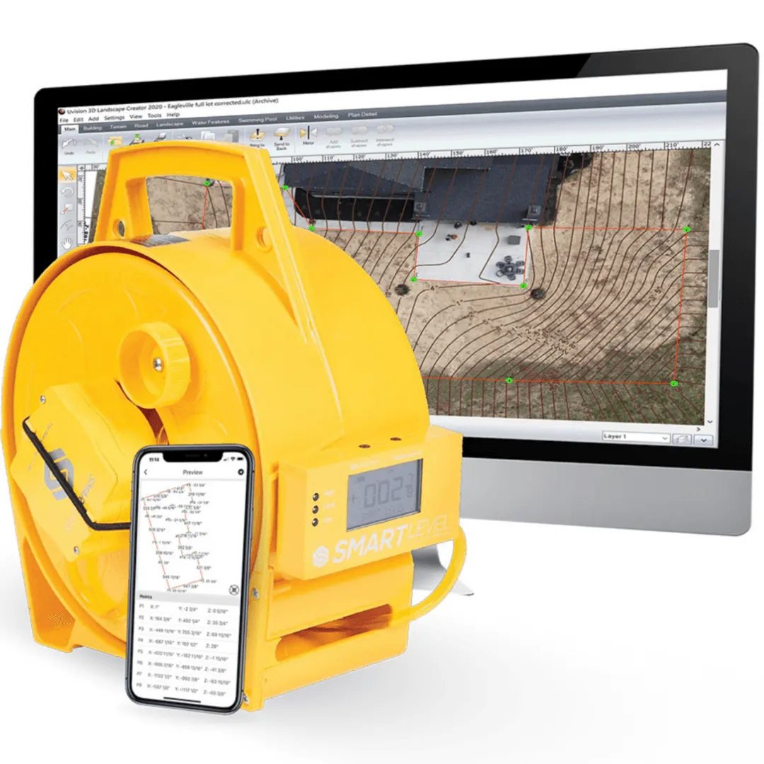
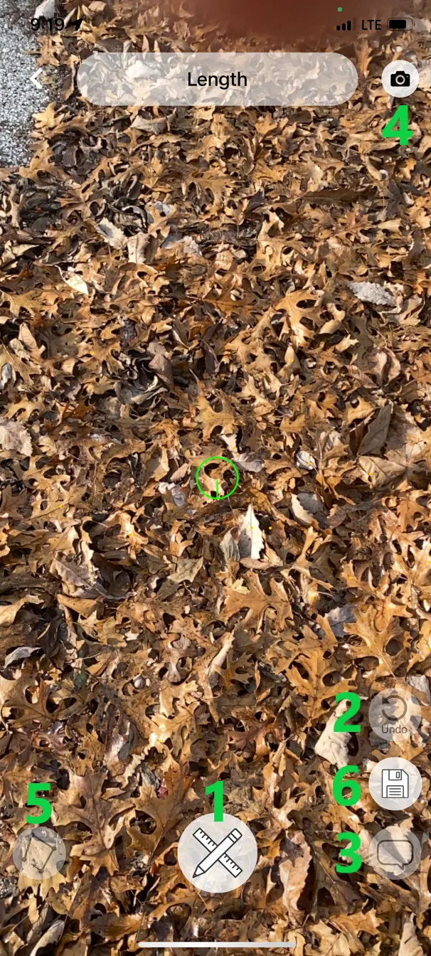
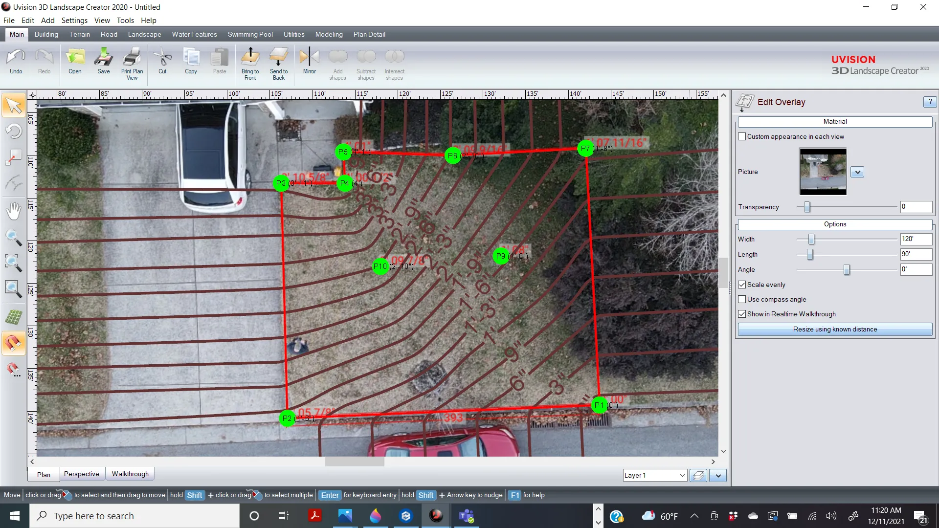
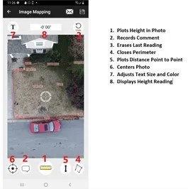
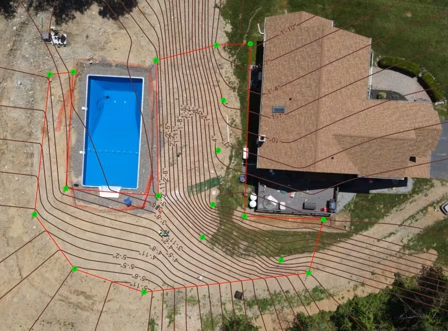
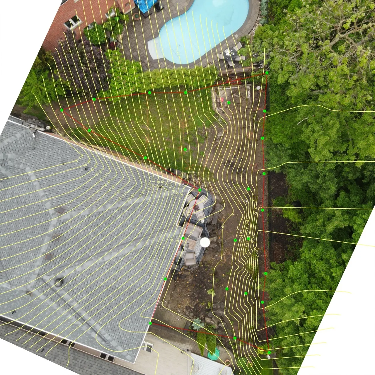
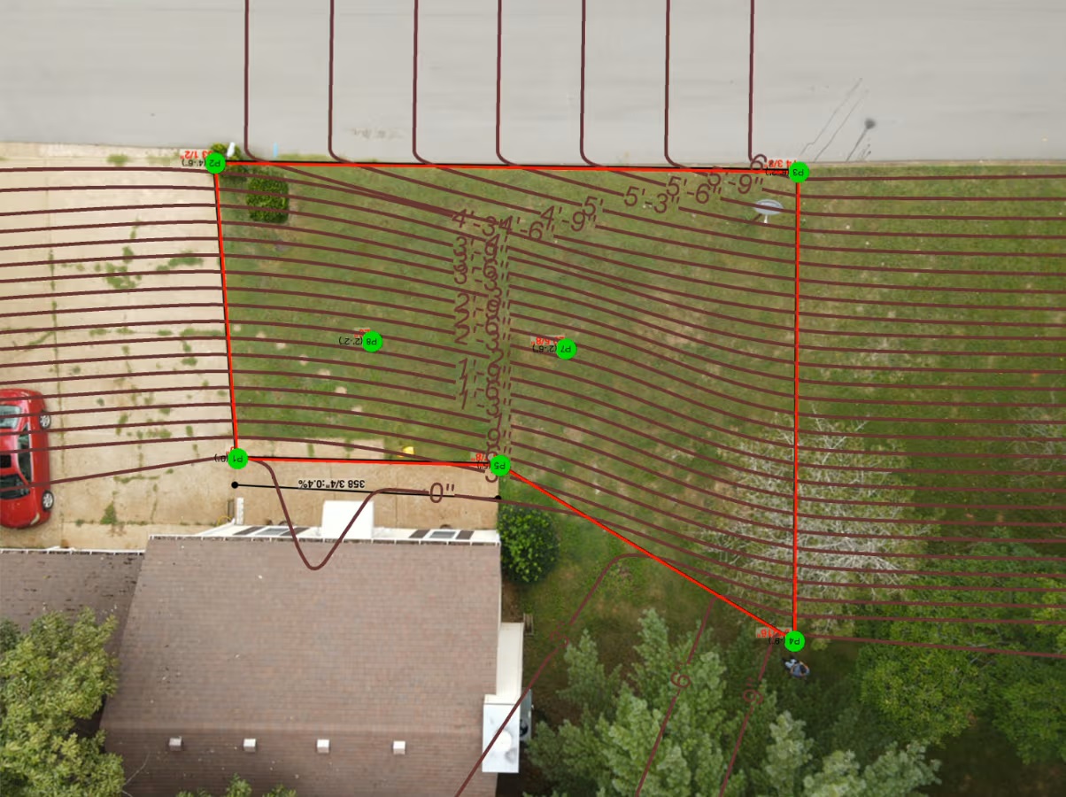
Survey your job site in True X,Y,Z format. Then upload the csv or dxf directly into cad for amazing designs!
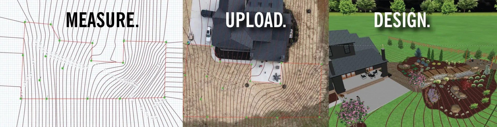
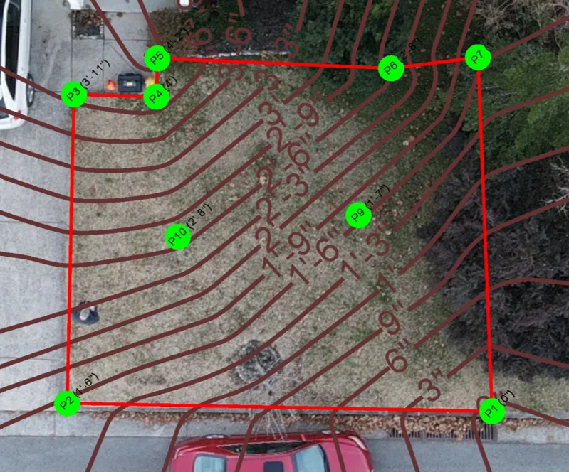
- Survey the area’s perimeter. This clearly establishes your working area. The red line defines the perimeter/working area. You need a minimum of 4 points but can add perimeter points anywhere the linear plane changes, dips or hills. There is no maximum number of perimeter points.
- Add interior and exterior points only when needed to map hills or dips. Too many points get confusing.
- Save into folders and name survey.
- You now have standalone data or you can email and upload into CAD.
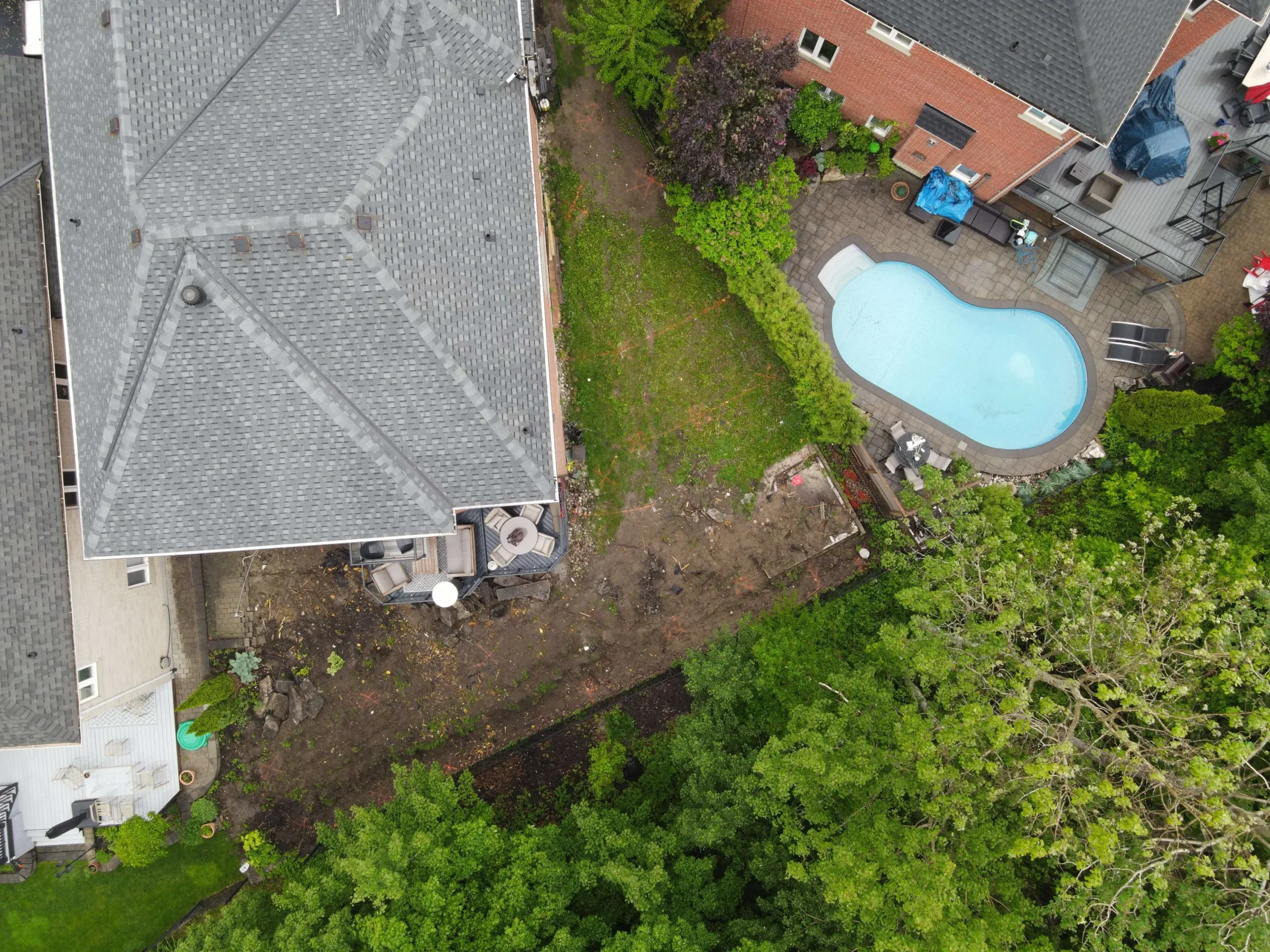
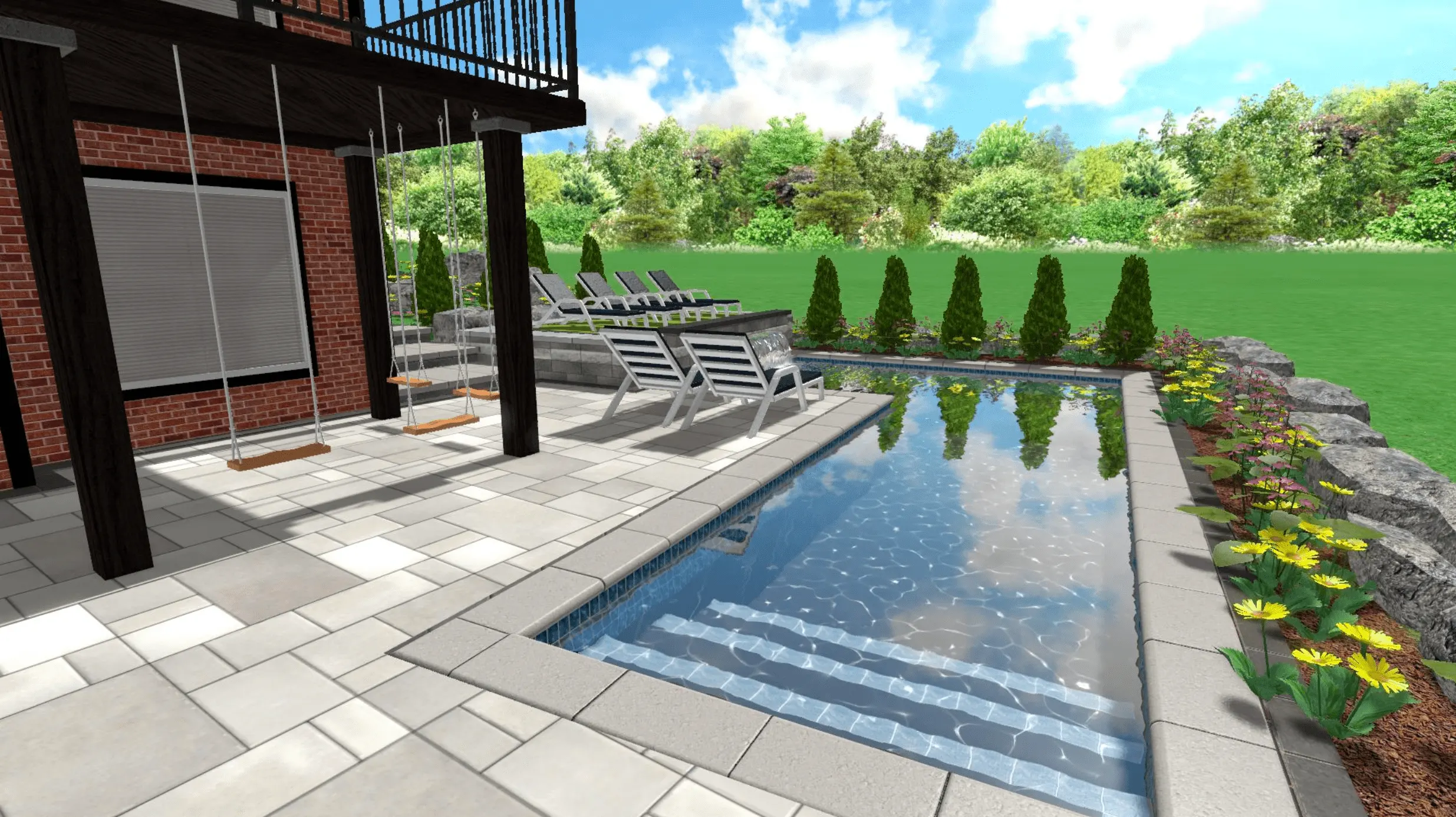
- After uploading initial survey, overlay a drone or aerial image for stunning results.