
Home Inspection
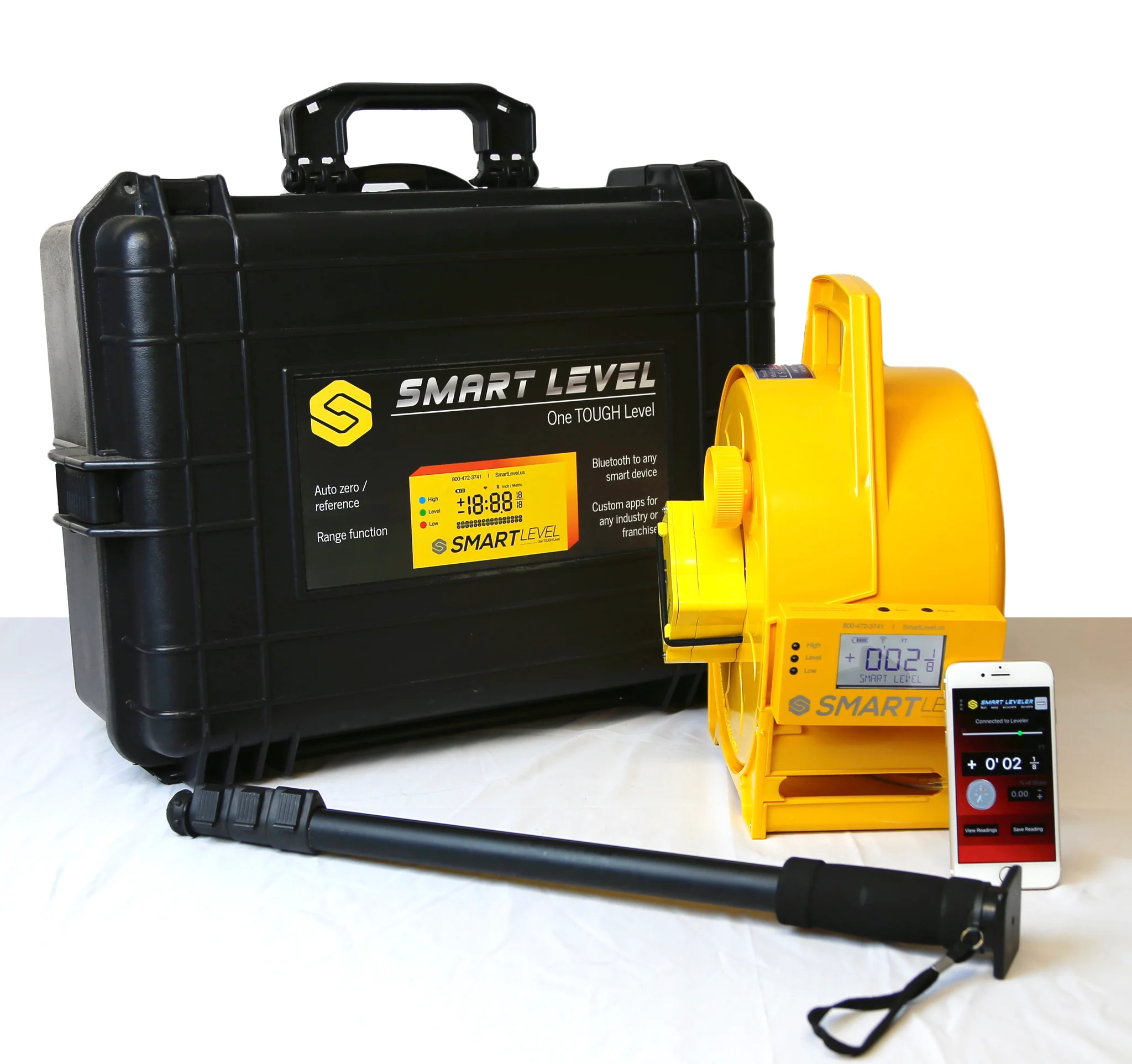
GAME CHANGING INNOVATION IN ELEVATION SURVEYS FOR HOME & STRUCTURE INSPECTION AND FOUNDATION REPAIR - SMART LEVEL TRUE 3D MAPPING IN REAL TIME!
3D Pool Design & Installation
CAD - The Future of Professional Pool Design. Easy as 1,2,3.
1. Smart Level quickly and easily surveys the job site.
2. Sends the data directly into your design program.
3. Create the homeowner’s dream!
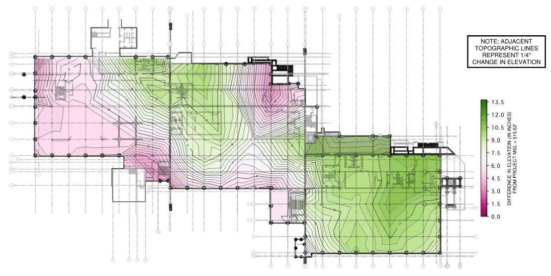
3D Terrain Mapping
 The newest Smart Level Android App with Image and 3-D Terrain Mapping is now public: Smart Level - Apps on Google Play or U-Level - Apps on Google Play There are a lot of different android phones out there so we will have a few adjustments to make as we introduce this newest version.
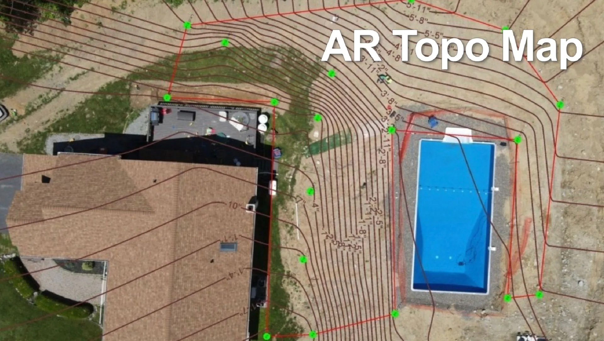
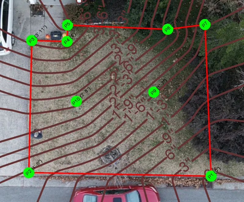
Android Image Mapping operates the same as IOS in creating a jpg image with the measurements quickly and easily. However, android takes Image Mapping to the next level, (pun intended). In android the Image Map also creates the XYZ survey in a csv file ready for upload into CAD. This is of course a very easy method to create a CAD survey of a job site. The downside is you need an overhead photo such as a drone image. And the image needs to be taken at a 90 degree angle, (straight overhead), to the job site.
Just take a photo and Smart Level
does the rest!
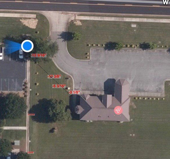
Simply load a photo from your phone into the app and then Smart Level will plot height and distance measurements directly into the image. This can be a photo you took on the job site with your phone, a drone image, a google map image, a pdf of a floor plan. Just about anything you need to measure and document.
- Load the image
- Set the Smart Level display where you want to measure.
- Align the crosshairs in the image with where you have set the display.
- Click add reading in the app. Its as easy as that!